Our goal is to help the COSEE Network reach rural and inland audiences. We create and evaluate interconnected tools and techniques that broaden understanding of oceans in the context of the earth and climate systems.
| |  |
| Click image to see and hear video |
ROLE Model Webinars
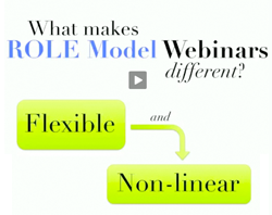
In the summer of 2010, COSEE-Ocean Systems (OS) debuted the ROLE Model webinar series in response to educator feedback requesting more interaction with research scientists. In addition to providing educators timely access to scientists and their ongoing research, these webinars provide an opportunity for scientists to interact with educators while presenting their research in a non-traditional format, through multimedia concept maps created with the Concept Map Builder (CMB) and presented through the Ocean Climate Interactive (OCI).
Unlike traditional slide-based presentations, these dynamic maps act as a resource that can be explored with an audience, instead of a one-way, linear presentation. The concept maps presented in the webinars are loaded with educational assets from the OCI database - including images, videos, and news items - which webinar participants can use in their own educational practices, presentations, or for their own learning.
The added benefit of online-based interaction is that participants can interact with colleagues from diverse locations and learn about topics that they may not have access to in their own institution, such as Gulf scientists talking about the effects of the oil spill on marine ecosystems. Ten scientists from six different institutions have presented in the ROLE Model series to date.
In total, the ROLE Model webinar series has reached 265 participants from 29 states, including the District of Columbia. Thirty-seven percent of these participants identified themselves as formal educators, 12% considered themselves informal educators. College faculty, science researchers and graduate students have also comprised a significant portion of the webinar audience. In the fall series of 8 webinars, 91% of participants who filled out the post-webinar evaluations reported that the webinar was “useful” or “very useful” to their work, 92% reported that they were more comfortable with the topic after watching the webinar, and 62% found that it was more relevant to their teaching.
The webinar series has also generated 21 related blog posts, including those written by scientists and educator presenters to reflect on their experiences or to answer further questions raised during or after the webinar.
The model for these webinars has been applied in several additional venues, including the recent Many Learning Pathways in Ocean Sciences webinar series, featuring ocean and climate scientists paired with education scientists from across the country. The series will continue to highlight scientists making significant contributions in their fields and will be a forum for sharing successful strategies for increasing diversity in the ocean sciences community.
 | |
Concept Linked Integrated Media Builder | |
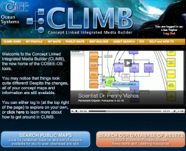
CLIMB Software DebutIntegrating feedback collected from a diverse audience of workshop participants, COSEE-OS has recently released a new version of its suite of software tools. What was originally developed as two separate tools - the Ocean Climate Interactive (OCI) and the Concept Map Builder (CMB) - is now merged together into a new application with many added capabilities, called the Concept Linked Integrated Media Builder or
CLIMB.
Some of the major changes in the new version, which was launched at the end of May 2011, include ways for users to more easily manage their maps, including the ability to create folders, preview maps, and share maps in fewer steps; publish their maps for anyone to view and download; browse concept maps that other users have created and made public; and view their maps on a re-designed concept map viewer.
The Concept Map Builder has also been given an update with some added functionality, including the ability to create concepts that can be toggled on/off by color when presenting. For educators, CLIMB includes a search tool linked to the database of educational assets in the OCI and allows users to save their favorites to their personal library.
Faculty-Graduate Student Collaborative (FSGC) Workshops
| |  |
| Faculty-Graduate Student Workshop at USC |
Two COSEE Centers have implemented the FSGC workshop model that was
piloted at UMaine. In early April 2011, COSEE-West hosted an
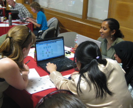
FGSC workshop at the University of Southern California (USC). Five scientists from USC, University of California Los Angeles, and California State University Long Beach collaborated with 20 graduate students from the region to develop concept map-based presentations for high school students. On the final day, the graduate students interacted with an audience of high school sophomores from Tesseract High School (Phoenix, AZ), who provided specific feedback on the effectiveness of their presentations. For an in-depth description of this workshop written by COSEE-West staff, visit
here.
In mid-May 2011, COSEE NOW held a two-day FGSC workshop that brought together five teams of scientists and graduate students from Rutgers University. The teams developed presentations tailored to audiences representing different segments of the general public. Professional staff from the American Museum of Natural History, Liberty Science Center, and an independent producer of ocean science education documentaries gave feedback in the context of their own organizations’ education and communication efforts.
Preliminary evaluation feedback from faculty and graduate students indicates that both workshops were interesting and valuable to faculty and graduate students alike. This fall, COSEE California will hold another FSGC workshop at Scripps Institution of Oceanography. The goal will be to team young faculty with NSF Graduate Teaching Fellows in K-12 Education (GK-12) to co-develop content that addresses broader impacts.
Visit COSEE-Ocean Systems!

