
Goals
Information on sailing and navigation:
Brown, Alan. Invitation to Sailing. Simon and Schuster, New
York, 1962.
Farnham, Moulton H. Sailing for Beginners. MacMillan Publishing,
New York, 1967.
Time
4-6 Hours
Procedure
1. Introduce students to the terms: knots, direction, distance,
degrees, and compass through classroom discussion.
The definition of the words are as follows:
3. Use mathematic conversions to figure out the use of distance
while on the sea. Depending on the curriculum and
the level of the mathematics skills
of the students, you may want to review or teach a lesson on conversions
of
units as well as the metric system,
and the United States system of measuring.
One Nautical Mile (nm):
1.85 kilometer
1.15 mile
Example conversions:
1. How many miles in 5 nautical miles?
2. How many feet in 5 nautical miles?
3. How many nautical miles in 7 miles
4. How many kilometers in 23 nautical miles?
5. How many meters in 23 nautical miles?
4. Use mathematic conversions to convert knots to miles per hour
to enhance the students’ understanding of the
speed of the sail boat throughout the
story. (May want to review or teach a lesson prior to this lesson on rates,
particularly miles per hour.)
One knot (kt):
one nautical mile per hour
1.87 km per hour
1.15 mile per hour
Example usage and questions for Voyage of the Frog:
P. 20: David is sailing 7 knots, how many miles per hour is this?
P. 23: David is sailing 8 knots, how many miles per hour is this?
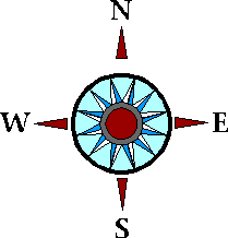
5. Work with the degrees in a circle to enhance understanding of the compass and direction.
6. Practice using a compass by doing the following activity:
While in a large group, the teacher will
call out a degree to face and the students can use the compass to face
that direction.
7. Demonstrate to the students how to use a map to plot the different
routes that they will take during the following
outdoor activity.
Outdoor activity (can be done in an indoor commons area or gym)
A. Before you start the activity,
set up different ‘islands’ in the chosen area. These ‘islands’ can be
an ‘X’ on
the ground, can be placed on trees, or they can be certain points that
students will recognize as an ‘island’.
Place
some of them close so they will have to follow the compass precisely, place
an island directly behind
another so that the students will have to pay attention to the distance
that they must travel in order to choose
the right ‘island’. Posted on the ‘islands’ will be a science orientated
survival tip such as: Do not drink salt
water when sailing in the ocean. Create a Map of the Area showing all
of the ‘islands’ so the students can
visually see each route that they took.
B. Have the students count out
the number of steps it takes them to walk 10 yards. To be accurate, have
them
do it twice. This will ensure that during the activity, students will
walk precisely to the ‘island’. Each
student has a different length stride. With this part of the lesson, the
route sheets can be used for any student
(the distance should be in yards). Each student will know their own number
of steps in 10 yards so each
students will be traveling the same distance. For example, when given
the information to travel 30 yards,
some may be traveling 13 steps per 10 yards and others will travel 12 steps
per 10 yards, but in the end they
will all move 30 yards regardless of the steps that they take.
C. Give different routes to students.
Start with the easier sheets and endwith the harder ones. (See sample
route sheets for easy routes, hard routes will have more steps.) See Sample
Route Sheet #1.
See Sample Route Sheet #2.
D. Students will use the orienteering
compass, direction on route sheet, and the distance to the ‘island’ to
get to
each ‘island’. At each ‘island,’ students will collect a survival tip.
For example, if the student is instructed
on his/her sheet to turn 30 degrees east and to walk 30 yards, they will
turn the amount of degrees, using
the compass and will walk 30 yards. They will then find the survival tip
and answer the questions on the sheet.
E. After each student is done,
he/she can bring the route sheet to a teacher and have it corrected. If
the route is
the correct route which is determined by the survival tips that they gathered
from each ‘island,’ they can begin
a more complicated route. If they do not have the correct survival tips,
he/she must retrace their route to find
the correct ones.
F. Before the student moves on
to a new route, he/she must map out the route that they took on a map of
the area
which is already made for them.
8. Do the journal activity - See Reading
and Journal lesson plan for possible journal questions for this activity.
Assessment
1. Math - Applied mathematics,
speed, rate, problem solving skills
2. Social Studies - Survival
skills
3. Science - Survival tips
that are science orientated, scientific principles that allow the compass
to work correctly.
Extensions
1. Use the Internet to find examples
of the use of the words in procedure #1.
2. Students can make their
own route in teams or individually.
3. Speaker on use of compass:
Forest Ranger, Ship Captain.
Go Back To S.O.S. Survival on the Sea Outline
Submitted By St. Norbert College Ocean Voyagers Program